The description of World atlas & world map MxGeo
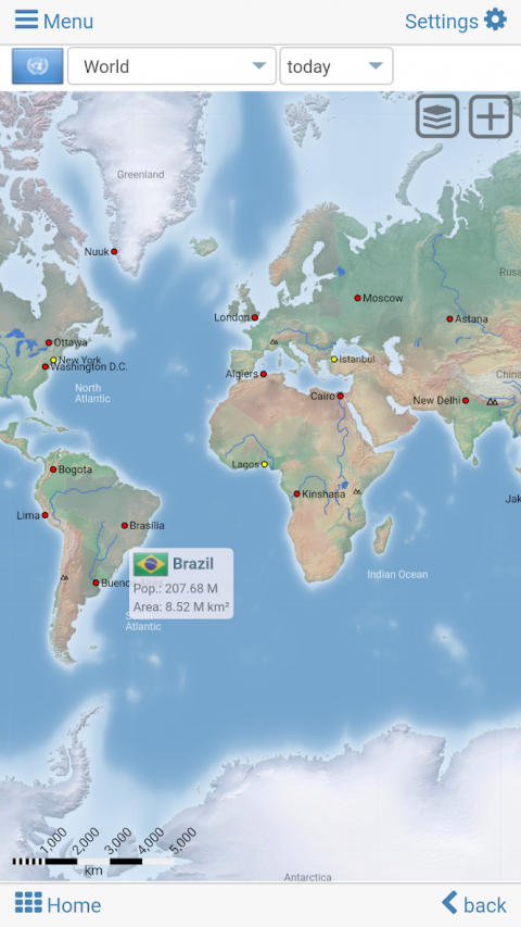
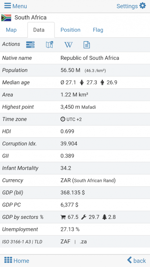
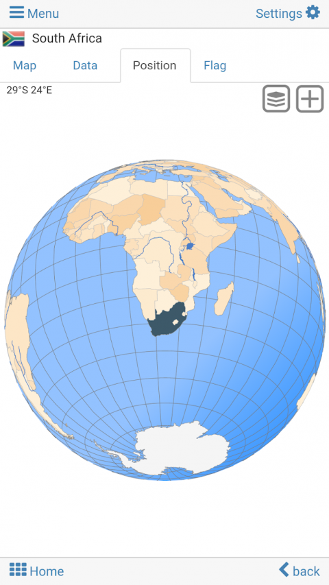
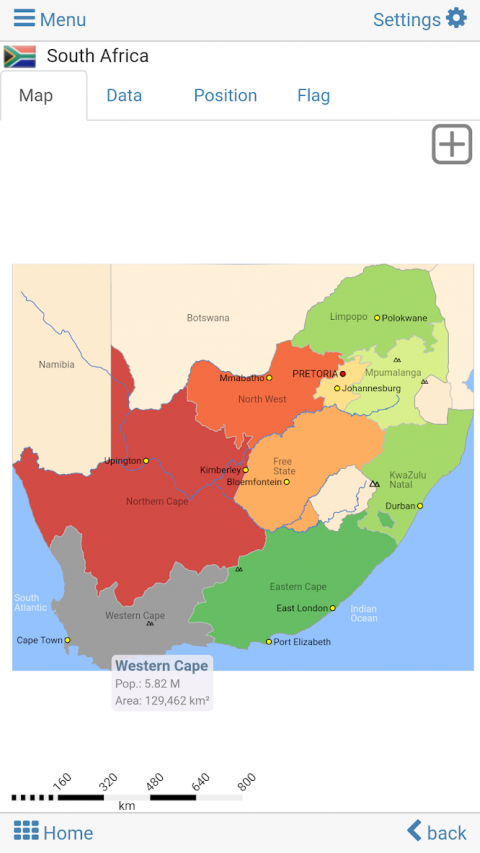
Worldatlas,worldmapandeducationalappforgeography.Flags,positionmapsandbasicdataformorethan260countriesandterritoriesoftheworld.PoliticalmapswithregionalunitsandcomprehensiveeconomicandstatisticalcountrydataforallAfricancountries.Designedforsmartphonesandtablets.•Flags,positionmapsandbasicdataformorethan260countriesoftheworld•Searchforcountries,majorcities,rivers,mountains,lakesorcoordinates•Interactivepoliticalworldandcontinentmaps•Shadedrelieflayerforworldandcontinentmaps•Geographyquizchallengeforplayfullearning•Countrycomparison,favoritesanddistancecalculator•ComprehensivemapsanddataofallAfricancountries•Choroplethmaps:areaandpopulation•Worldclockwithtimezonedisplay•World-explorer:thesmallest,largest,...countries•NoonlineconnectionrequiredExploretheworldbypoliticalworldandcontinentmapsofflinemaps.Learnwhereeachcountryintheworldislocated.Viewitspositionhighlightedonadigitalglobe.Createyourfavoritecolorthemeorchoosefromdifferentcolorschemesformapdisplay.DoyouknowtheflagofZambia?Yes?Perfect.DoyoualsoknowinwhichcountryMountKilimanjaroislocated?“Worldatlas&worldmapMxGeoFree”Quizhelpsyouacquireageographicliteracyinaplayfulmanner.Choosefromsixgeoguessinggames:•TestyourknowledgeaboutthecapitalsofAfrica•DoyouknowtheISOcountriescodes?•Recognizethepropercountryflagbasedontheoutlinemap•Doyouknowthetop-leveldomainsofeachcountry?•Guessthehighlightedcountryonthevirtualglobe•DoyouknowthemountainsofAfrica?Geolearningappandeducationalgamewhichisfunforeveryonewhetherchildren,adults,seniorsorteachers.Getreadyforyournextstayabroadwhileenjoyingthisgreatworldalmanacincludingtimezonesandstatisticaldata,suchaspopulationgrowth,unemploymentrate,averageage,grossdomesticproduct(GDP)bysectorandotherkeyfigures.Orprepareforyournextgeographylessonwiththisgeniusdigitalworldmap.Ifnottravelingourworldatlasletsyouexploretheworldjustonlyvirtually.FreeversionincludescomprehensivedataandmapsforallAfricancountries.Get“Worldatlas&worldmapMxGeoPro”withdetaileddataandmapsincludingregionalunitsandcapitalsfor260countriesandterritoriesoftheworld:Europe,Asia,NorthAmerica,Africa,OceaniaandSouthAmerica.Versionhistory:Ver.1.x:•Worldmap,countrymapsandflags•Capitals,countryflagandvirtualglobequiz•World-explorer:explorethesmallest,largestandmostpopulatedcountries•Countrycomparison:quickcomparisonofcountriesandterritoriesVer.2.x:•Highresolutionflagsforallcountries•PopulationgrowthchartforallcountriesVer.3.x:•Shadedrelieflayerforworldandcontinentmaps•Interactiverotatingvirtualglobe•Worldclock:timezonesmapVer.4.x:•Additionalregionalpositionmaps•Distancesandareascannowbedisplayedinkilometersormiles•Adjustablefontsizeformaplabels•Choroplethmapsbyareaandpopulation
Show More
World atlas & world map MxGeo 8.2.8 Update
Publish Date: 2021-08-27
• Search for subdivisions like states or provinces
• Corrections and updates for maps and data
• New Quiz: the longest rivers
6.x:
• Search for countries, major cities, rivers, mountains, lakes and coordinates
• World Explorer: largest cities, longest rivers and highest mountains
• Quiz: Federal states for selected countries
• Distance calculator: more cities