
OsmAndNauticalChartsisanextensionforOsmAndMaps&Navigationapp,whichisenabledstartingfromOsmAnd2.0.
UsageInstructions:itishighlyrecommendedtodownloadnauticalbasemapinordertoseethemapsregardlessofdetailedmappresence.Nauticalchartsareprovidedasamapandaspecialstyle,toswitchstyleinOsmAndpleaseusethemenuitem'ConfigureMap'onthemapscreen.
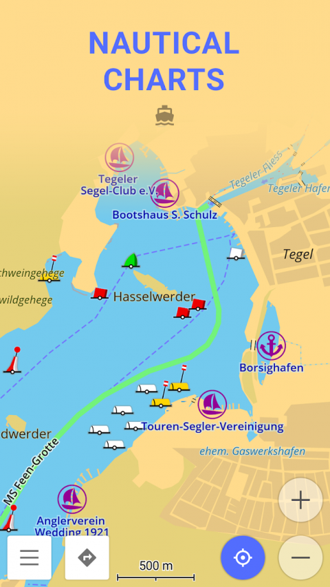
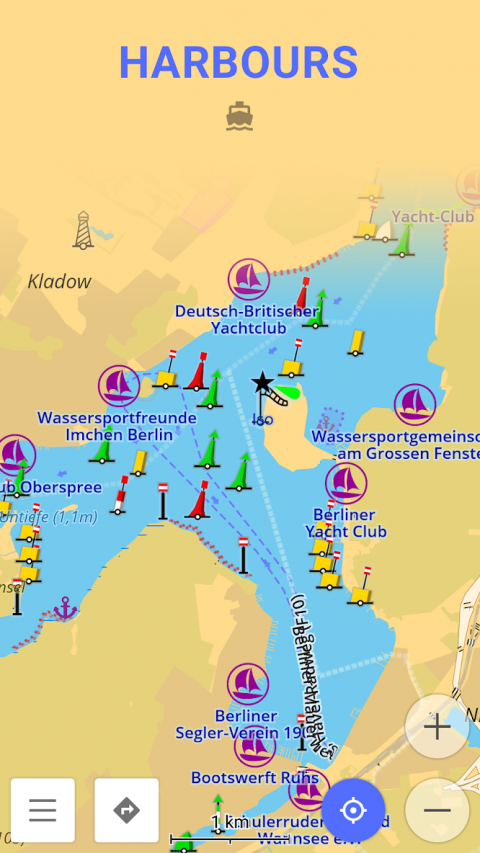
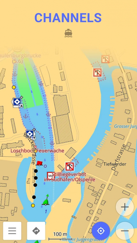
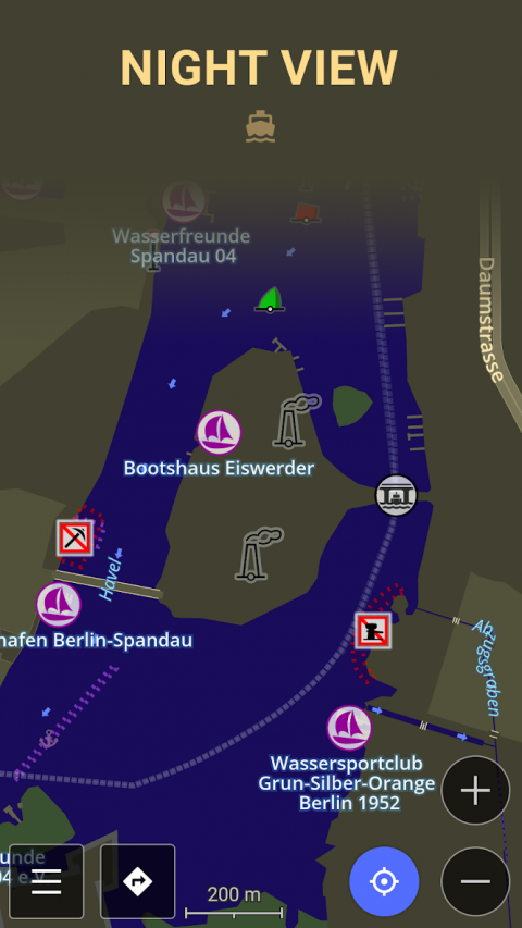
NauticalChartisadetailedgraphicalrepresentationofoceans,seas,coastalareasandrivers.
NauticalChartsaremadeforpeoplewhodriveanykindofvehicleonwater:fromprofessionalsailorstopeoplewhorentedaboattomakeatourovercitycanals.Thechartscancontainvariousinformationlikesailingroutes,navigationlights,dangerousareas,areaswhereit'sallowedornotallowedtosailordock,etc.
Alltheprofessionalsailorsareobligedtohaveofficialnauticalchartsontheirships.Thesechartsarepublishedbyauthorizedagenciesandcostquitesomemoney.Agenciesareinvestingalotinkeepingthechartsuptodate.Theyreleaseupdatesforthechartsonregularbasis,butbecauseofthefactthatreviewingtheinformationandprocessingtheupdatestakesquitesometimethenauticalchartsarenevercompletelyup-to-date.
NauticalchartsofOsmAndarebasedonthedatafromOpenSeaMapproject.Theideaoftheprojectistobuildthedetailedmapbypeoplehowactuallyuseit.Everyuserofthemapcancontributebyaddingchangestoitmakingitmoredetailedandmoreaccurate.
WhileOpenSeaMapchartsatthemomentcannotcompetewithofficialnauticalcharts,theycanbeusedbyrecreationalsailorsfororientationorrouteplanning.
Show More

-
Nautical Charts — OsmAnd
1.0for Android
OsmAnd