IsraelHikingMapisapowerful,yetsimpletouse,navigationandroute-planningtoolfortheoutdoors.
Gearedtowardshikers,bikersandoff-roaddriversitkeepsyouorientedintheIsraelibackcountryevenwithnocellularreception.Usecrisptopographicmapstonavigate,familiarizewithnearbypointsofinterest,plan,importandshareroutes,synchronizeeffortlesslywithourtrip-planningsiteandmuchmore.
Here’swhatyougetforfree:
Maps
-Vectormapswithunlimitedzoomwithnolossofquality
-Ahikingmap,completewithblazedtrails.
-Abikingmap,competewithsingletracksmarkedfordifficultyandmarkedbikeroutes.
-HebrewandEnglishversionsofallmaps
-Textlabelsthatorienttotheviewers’perspective
-Asatelliteimage
-Transparentmapoverlaystoshowtopographyandtrailsoverthesatimage
Depthperception
-HighresolutioncontourlinesbasedonspatialdatafromNASA
-Dynamichill-shadingwhichchangesasthemaprotatesforaccurate
depthperceptionataglance
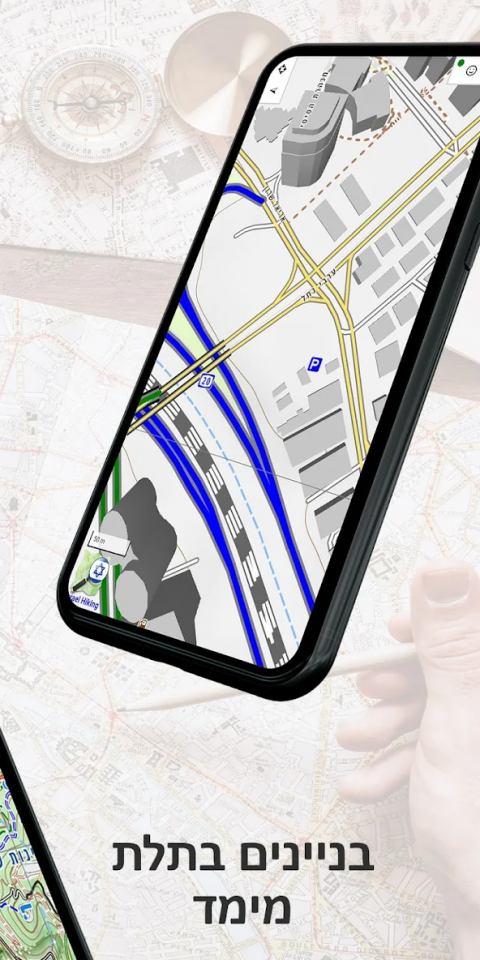
-3Dmodelsofmanybuildingsinurbanareas
Navigation
-Showyourpositionanddirection
-Orientthemapnorthorinyourdirectionofmovement
-Recordyourpathasyoutravel
-Analyzeyourspeedanddistancetraveled
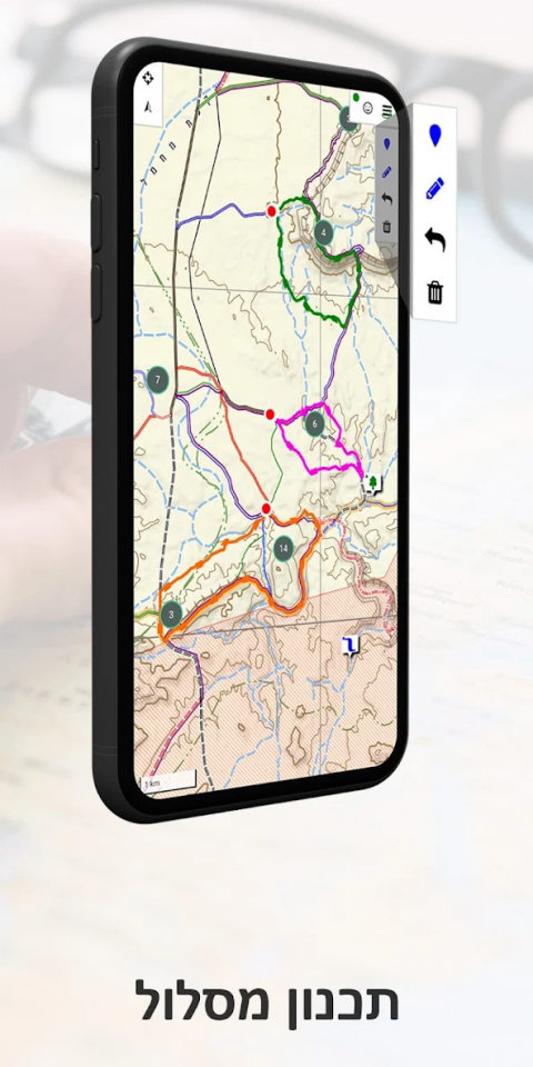
Routes
-Searchfornearbyroutesforwalking,drivingandbiking
-Planyourownroutes–theywouldautomaticallyfollowtheroadsandpathsonthemap
-Manipulateroutes–reverse,splitormergethematwill
-Handleseveralroutesatonce
-Effortlesslysynchronizewiththeroutesyouplanonourwebsite
-Shareroutesorsavethemonyourphone
-Analyzetheheightprofileofroutes
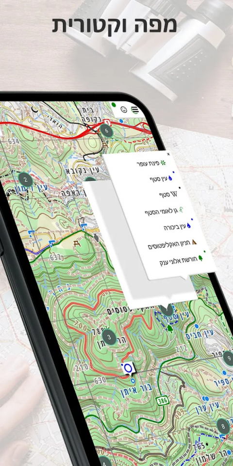
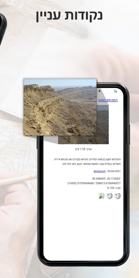
Pointsofinterest
-Anextensivelistofhistoricalsites,touristattractions,campsites,springsandviewpointstovisit
-Easyaccesstogeo-locatedarticlesfromWikipediaandiNature
-EasilyaddyourownPOIstothemap
Offlinemappurchase
Youcanbuyayearlysubscriptiontoourofflinemaps.Usethemwhenyouareoutofreceptionorwanttosaveyourbattery.Themapsarecontinuouslyupdated.
Show More
-
Israel Hiking Map
9.8.1for Android
Israel Hiking