
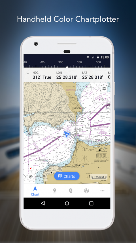
**NavigateConfidently,NavigatewithiNavX-theworld's#1MarineNavigationApp
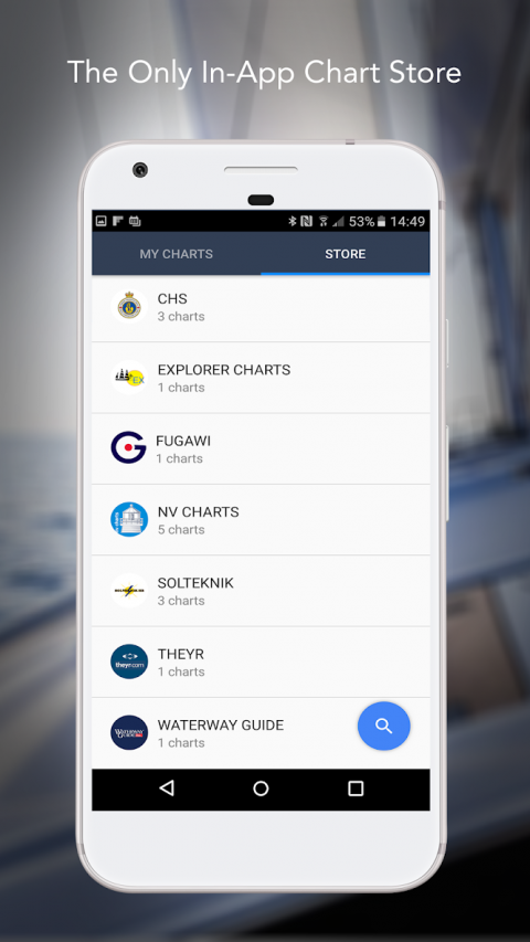
**And,theONLYapptoprovideallyourfavoritechartsfromyourfavoritechartproviders
“Editor'sChoice”-PracticalSailor
"TheStandard"-CruisingMagazine
"MustHaveList"-CruisingWorld
Trustedinternationallybycasualandprofessionalsailors,cruisers,boaters,fishermen,anddivers.
DownloadsiNavXTODAYandautomaticallyreceiveacomplimentarycopyoftheofficialandup-to-datehighresolutionNOAARNCUnitedStatesmarinerastercharts.
iNavXistheONLYAPPtogiveyouaccessallofyourfavoritechartsdirectlythroughtheapp.Fullyenabledwithone-touchpurchaseanddownload,iNavXgivesusersthemoststreamlinedaccesstothebroadestsetofmarinechartsandmapsfrommultipleproviders.
•NAVIONICS
•DELIUSKLASING
•EXPLORER
•BLUELATITUDE
•THEYRWEATHER
•WATERWAYGUIDE
•...andmore
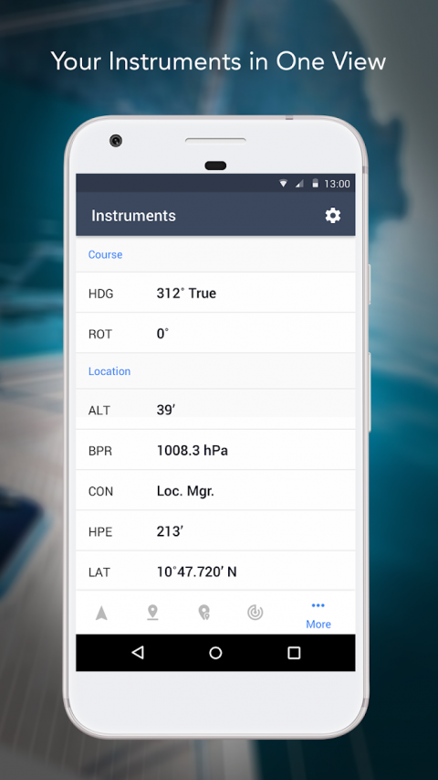
iNavXtakeshandheldmarinenavigationtothenextlevel.
•Anglers:Discovernewfishingspotsbyscoutingoutdeepholesandinlets.Locatethebestfishingconditionsbyidentifyingcoldfronts.Saveyourbestfishingspotswiththeonlyappthatoffersunlimitedmarkers.
•Sailors:Plangreatrouteswithwaypointandroutemanagement.HaveproactivesailmanagementwithGRIBweatherforecasts.ThenkeepwatchwithintegrationwithexternalAISreceiversandresponders.Andremembergreatlocationsbygeotaggingphotos.
•Boaters:Stayuptodateonboatingconditionswithweatherforecaststhatincludescurrents,winds,andswells.Thensaveandsharegreatboatingroutestosharewiththetracklog.
ADVANCEDFEATURES-iNavXisthemostfeaturerichappavailable
AdvancedChartPlotter
•Plotyourpositioninreal-timeusingyourdevice'sbuilt-inGPS
•Easilypan,zoom,androtatecharts(includingcourseup)
•Printadetailedcharttouseincombinationwiththeapp
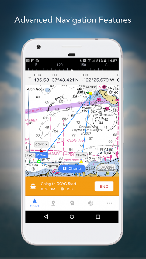
AdvancedNavigation
•Createwaypointsandplanroutestonavigatebetweenthem
•Tracklogallowsyoutorecordyouractualroute
•Import/ExportdatainKML(GoogleEarth)orGPXformat
REVIEWS
“iNavXistheoriginalandstillthebestnavigationapp.”–PracticalSailor
“Themostfull-featurednavigationapparoundandviewedbymanyasthestandard”–SailMagazine
"The#1recommendedmarinechartingapp"-iMarineApps
Show More

-
iNavX
1.5.5for Android
NavX Studios