The description of Marine Navigation Lite
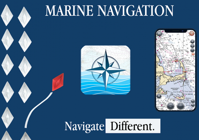
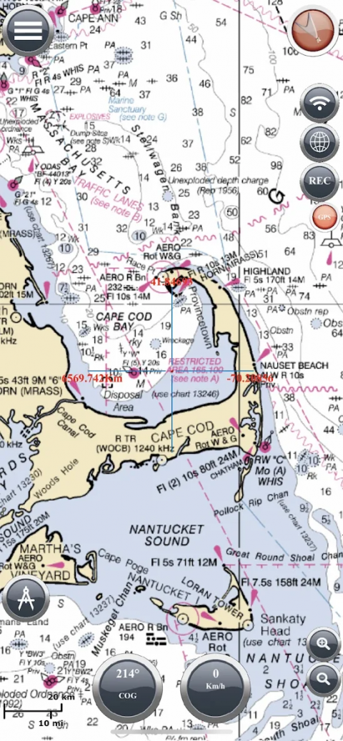
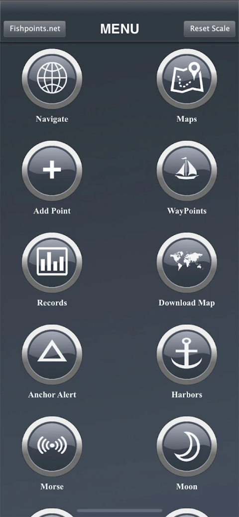
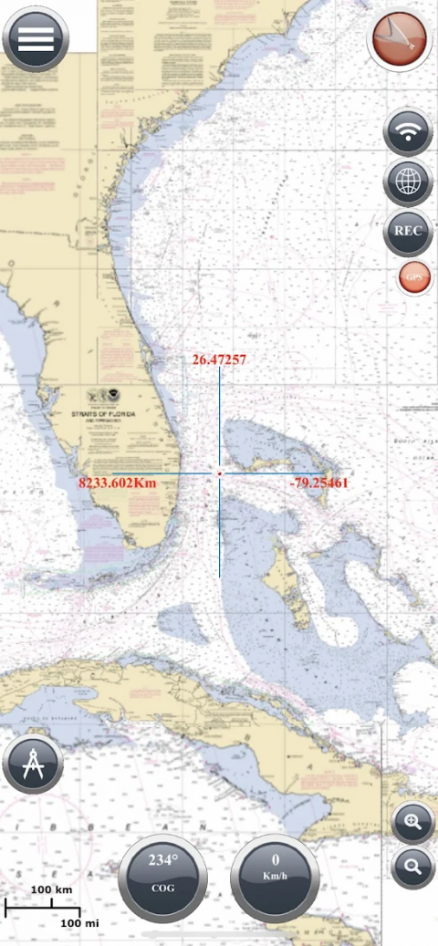
MARINENAVIGATIONFindyourroadonthesea!GPSchartplotterforboating.Aneasy-to-useofflineGPStrackerandrouteplannerfeaturingworldwideofflinemaps.Navigatewithyourfavoritedevicearoundtheworld,turnyoursmartphoneortabletintoaGPSnavigatorwithanofflinemap,idealforsea,riversandlakes,forboaters,fishermenandwatersports.Thisapplicationisdedicatedtotheseaandthepeoplewholoveitandliveitwithpassion.WHATMAKESITABESTGPSTRACKERORNAVIGATOROfflineGPStrackerforboatnavigation.GPSChartplotterforSailing&boating.MorseCodeincaseofdanger,AnchorAlerttopreventthedriftoftheanchor,MoonPhasetoshowthephasesofthemoonduringtheday,Harborstoseethelistofports,SyncWaypointstobeabletocreatebackupsandaccessthemfromdifferentdevices.Youalsogettodownloadthemapsandmarinecharts,soyouwon’tneedanactiveinternetconnectionwhenitcomestogettingnavigationandrouteplanning.Ifyoucreateaprofile,youcansavewaypointsandroutestoaccessthemfromdifferentdevices.AllyouhavetodoislogginginwiththesameaccountandenjoyseamlessseaGPSnavigations.So,nomatteryouareaprofessionalsailororfisherman,oryouareanamateurwholiketravelinginthesea,MarineNavigationhasgotyoucovered.It’saversatileseanavigatorappandboatingrouteplannerwhichprovidesaccurateGPSChartplotterandmarinecharts.MAPSOFFLINE:Downloadmapsormarinecharts,youneedaselectareaandapplicationsavetileintoyourdevice.Navigateonpreloadedmapswithoutconnection.MAPSANDMARINECHARTS:MapView:http://www.fishpoints.net/mapsview/•NauticalmapsoftheUnitedStatesofAmericabyNOAA•NauticalmapsoftheMediterraneanbyNOAA•MediterraneanRNC•NauticalmapsoftheNewZealandbyLINZ•Mapsoftheworld’soceansandcoastalareasbyESRI•Worldtopographicmapincludesboundaries,cities,waterfeatures,ports,physiographicfeaturesbyESRI•SatelliteimageryfortheworldbyESRI•Mapsforthesea,withports,sealightandmorebyOpenSeaMapMarineNavigation:GPSTrackerMainFeaturesataGlance•SupereasytouseGPStrackertool•Cleanandneatdesign•Availableindifferentlanguages:English,Italian,French,Spanish,Brazilian,TurkishandGerman,Indonesian•DownloadMapstouseinofflinemode•AccurateanddetailedGPSChartplotter,GPSplotterandMarinecharts•Optimizedforphonesandtablets•Syncroutesandwaypointstoaccessthemanywherefromanydevices•Moonphase•MorseCode•Receiveinformationaboutspeed,direction,timetoarrival•Compass•ChangeMeasurementUnits:Km,Mi,orNmi•RecordyourrouteforanalyzethedataandnavigateagainLOCATIONPERMISSIONLocationinformationisprocessedlocallyonyourdevice,ensuringyourprivacy.HELPUSDownloadMarineNavigationandletusknowaboutanybugs,featurerequestsoranyothersuggestions.StaytunedformorefeaturesandoptionsinthisGPStrackerappforboating.WARNINGGoodseamanshiprequirestheuseofofficialcharts.MarineNavigationisforusewithotherchartsandcannotreplaceofficialcharts.Useatyourownrisk.LEARNMOREABOUTFISHPOINTShttp://www.fishpoints.netIMPORTANTINFORMATIONABOUTSUBSCRIPTIONSPayment:willbechargedtoPlayAccountatconfirmationofpurchase.Subscription:isautomaticallyrenewedonthesameaccount,unlesstheautomaticrenewalisdeactivatedatleast24hoursbeforetheendofthecurrentperiod.ManageSubscription:insideAccountGooglePlaySettings.
Show More
Marine Navigation Lite 6.3.22 Update
Publish Date: 2021-10-22
6.3.22(2021-07-06)
- Removed Subscription Plan
6.3.21(2021-05-21)
- Bug Fix
6.3.18(2021-04-18)
- Ports List Offline
- No More Login Needed
- Bug Fix
6.3.0(2021-04-15)
-No More Account Needed
-Fix Navigation View
-Fix Port Navigation
6.2.5(2021-04-11)
-GPX Export/Import
6.2.00(2021-04-02)
-Weather
6.1.27(2021-03-21)
-Improved map's zoom function
6.1.15(2021-03-10)
-New Map with Bathymetry and Depth
6.1.12(2021-03-07)
-BugFix